Discover the city from a completely different perspective - interested people can now do this online. The City Surveyor's Office Frankfurt has published new aerial photos of the aerial survey of Monday, March 30. And everyone can now take a look at these images. You can see the aerial photos at: https://geoinfo.frankfurt.de view.
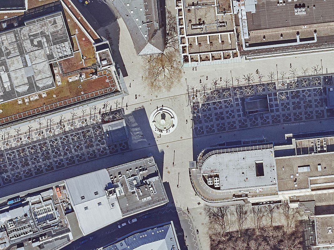
"This is another free offering for anyone interested in ‚Frankfurt from above,'" says Planning Director Mike Josef. "What's interesting is how the current aerial photos also show the effects of the lockdown." For example, in direct comparison to the aerial images from the previous year (aerial survey of Tuesday, April 16, 2019), significantly fewer pedestrians can be identified on the Zeil or on the Römerberg. The tables in the outdoor areas of the restaurants are empty and deserted. The photos of 2019 and 2020 were both taken around midday - the time during which the city center is actually particularly busy.
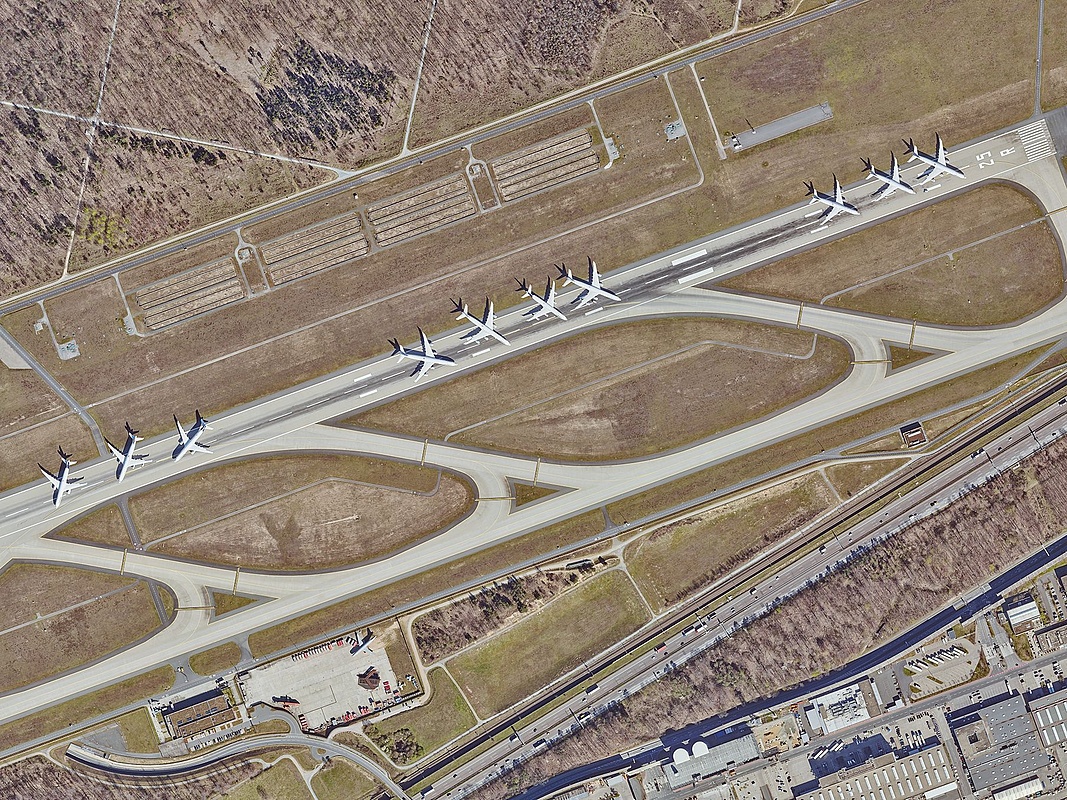
But there are also fewer vehicles on the streets of Frankfurt in 2020 than we know from previous years. This can be seen very well at the intersection of Mainkai and Alter Brücke. Here you can also see impressively the new red cycle path markings. And the impact on air traffic at Frankfurt Airport can be seen in the northwest runway, which has been converted into a parking lot for aircraft. The progress of the construction of the S-Bahn to Bad Vilbel near Bockenheim can also be seen very nicely in comparison with the aerial photo of 2019.
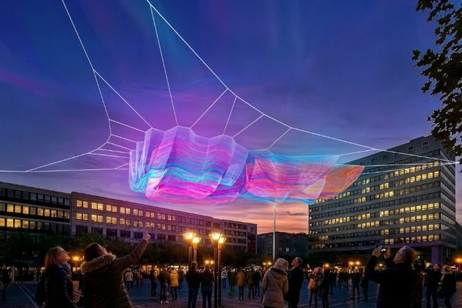
An interesting aspect of the unfortunately cancelled Luminale 2020 can be seen in the aerial photos: The BlauRaum light installation - more on that at https://www.luminale.de/projekte/blauraum/ - in Fahrgasse has left its mark on the aerial image.
The original new aerial images are available in the detailed ground resolution of eight centimetres. That means one image point (pixel) corresponds to an area of eight by eight centimeters in nature. The 2020 aerial photographs can also be purchased at:
Geo Service Center City Survey Office
.Kurt-Schumacher-Straße 10
60311 Frankfurt am Main
Phone 069/212-49958
E-mail Geo-Service-Center.stadtvermessungsamt@stadt-frankfurt.de